The Cleveland Way
Distance - 110 miles (177 km)
Start - TA 034 264- Hessle, E. Yorkshire
Finish TA139814 - Filey Brigg, N. Yorkshire
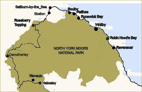
The Cleveland Way National Trail runs for 110 miles (177 km) along the North Yorkshire Heritage Coast commencing at Helmsley it continues to Filey Brigg, skirting the North York Moors National Park. The trail runs through some superb scenery, passing castles, ancient stone crosses and quaint fishing villages tucked into tiny coves. The trail was officially opened in 1969 and was the second official National Trail to be opened.
The tail starts in the centre of the picturesque market town of Helmsley in the North York Moors and and continues over wild upland moorland before dropping down to the coast at Saltburn. The final final 40 miles of the trail follows the cliff top path to a finish at Scarborough.
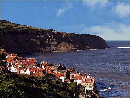
The trail falls into two roughly equal sections. The inland section leads west from Helmsley, then heads north, then east skirting the North York Moors National Park passing Roseberry Topping, an iconic hill, near the villages of Great Ayton and Newton under Roseberry, on the western edge of the National Park, a spur of the Cleveland Way runs up to the summit. The trail then leaves the National Park near Guisborough to meet the coast at Saltburn. It re-enters the National Park just north of the picturesque fishing village of Staithes the coastal section follows the coast from Saltburn to Whitby, then leaves the National Park for the final time at Cloughton Wyke to reach Scarborough and Filey.