Danes Dyke
OS grid reference:- TA 215 695
 The name given to the massive bank and ditch earthwork of Danes Dyke is misleading, as it seems to infer that it was constructed by Danish invaders, while it does in fact, date back to the Iron Age. The earthwork divides the Flamborough Head peninsula from the mainland.
 Danes Dyke is a Scheduled Ancient Monument of national importance.The exact date of the construction of the dyke is not certain, while some date it to the Iron Age, other sources suggest similarities to post-Roman earthworks.
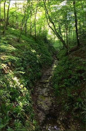
Danes Dyke was intended as a defensive structure to protect headland settlements. It consists of two constructed features, a flat-topped bank and a west-facing ditch. The bank was constructed from earth, stacked turfs and chalk rubble, much of which would have come from the ditch. The Dyke runs for 4km (about 2.5 miles) from the Danes Dyke Nature Reserve in the south to Cat Nab on the Bempton Cliffs in the north, enclosing a total area of about 5 square miles, and includes the most northerly outcropping of coastal chalk in Britain.
It once probably had a wooden pallisade fence. The scale of the construction compares with more famous, but much longer, ditch and bank fortification of Offa's Dyke on the Welsh border.
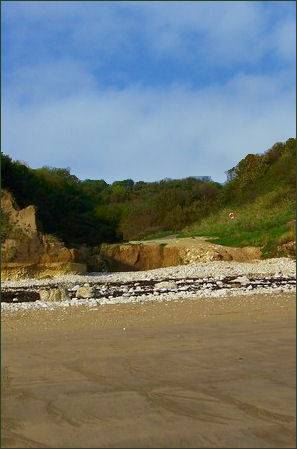
A nature reserve is situated at the southern end of the dyke, which has parking areas parking areas providing access to a network of footpaths. These trails allow visitors to access the shore, where there is a Quality Coast Award beach with chalk cliffs.
Other paths lead along the course of the Dyke, and through wooded countryside on either side. Further paths lead from the parking area in either direction along the clifftops, towards Bridlington, South Landing and Flamborough.
Directions
Take the B1265 from Bridington to Flamborough. There is a dip in the road into a wooded valley, turn right at the bottom of the dip to reach the car park.
Prehistoric and Roman Sites of Yorkshire