Wharram Percy Medieval Village
OS grid reference:- SE 858 646
 The deserted medieval village of Wharram Percy occupies a remote but attractive site on the chalk Wolds of Eastern Yorkshire.
Wharram Percy is the best known medieval deserted village in England, although there are many others. The village was researched by combined teams of archaeologists, historians and even botanists, from about 1950 to 1990 after its identification in 1948 by economic historian Professor Maurice Beresford of the University of Leeds.
The village's origins are much debated. Some experts believe that a scatter of small buildings with sunken floors, some possibly enclosed by earthworks, represents an early village, which can be dated by the presence of mid seventh century artefacts.
It is recorded in the Domesday Survey of 1089 where it is referred to as Warran or Warron, before the Norman Conquest it was the property of two men Karli and Lagmann, whose names indicate that they were Viking descent. After 1066 it was owned by King William the Conqueror, its value was recorded as £3.00.
From the twelfth century there were two manors at Wharram Percy, known to archaeologists as the North Manor and South Manor, one was owned by the influential Percy family, who later aquired the other manor also. The village flourished between the twelfth and early fourteenth centuries, when members of the noble Percy family lived there.
In the medieval era, the village had two main streets, one running up to the plateau while the other ran along its eastern edge and fronted onto the rows of medieval farmsteads. Several of the properties were divided into two areas, a toft, which stood closest to the street containing the houses of the villagers, with a croft, an enclosed strip of arable land behind it. The sites of two manors and homes belonging to the leading landowners in the village also stand on the plateau.
 The bubonic plague or Black Death that spread through medieval England 1348-49 does not seem to have played a significant part in the desertion of Wharram Percy although the large fall in population in the country as a whole at that time must have made relocation to a less remote spot more likely. The population of Wharram Percy was perhaps reduced from about 67 to 45 by the plague.The villagers seem to have suffered instead from changes in prices and wages in the fifteenth century, which rendered sheep farming much more profitable than traditional cereal farming. In 1403 the Hilton family of Sunderland purchased the manor and began to convert farmland to sheep pasture.
 Over the course of the late Medieval era, the rising price of wool, the raw material for England's increasingly profitable export of woollen cloth, induced many landowners to switch to sheep farming, converting arable land to pasture. The village was finally abandoned in the early sixteenth century when Baron Hilton, the lord of the manor, turned out the last few families and had their homes demolished to make room for more sheep pasture. The last four families were evicted between 1488 and 1506.
A testimony referring to the eviction of four families from Wharram Percy and the destruction of their houses by Baron Hilton in about 1500 was long thought to mark the final act of depopulation. It was, however, apparently part of a longer process, for there seems to have been a sharp decrease in the village's population after 1458. This may have been caused by evictions that went unrecorded, although a few houses continued to be occupied after 1500 by smallholders and shepherds
Archaeologists revealed that the last inhabitant of Wharram Percy was either a vagrant or an inhabitant who refused to move out, who was killed when a dilapidated house collapsed on him whilst he slept.
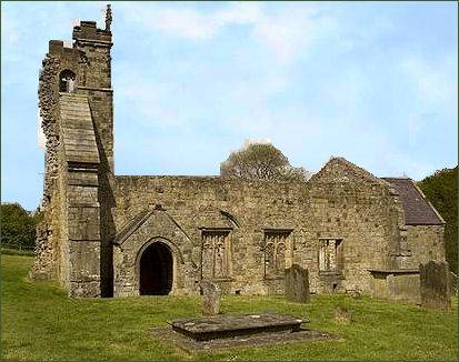
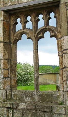
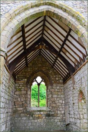
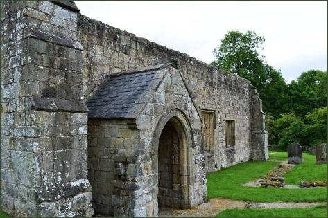
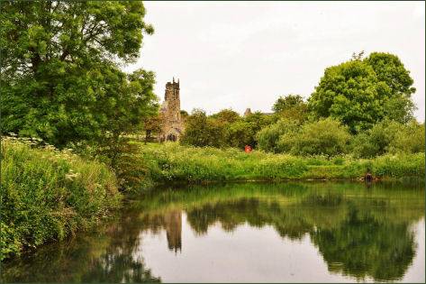
The church of St. Martin is one of the most thoroughly studied parish churches in England. The church was completely rebuilt in the twelfth century and enlarged through the thirteenth and fourteenth century. In the fifteenth or sixteenth century it reduced in size as the village came to be deserted.
Although only the ruined church of St Martin still stands, there is a recreated Norman manor house and fishpond and much more of the village layout, including the stone foundations and earth works of 30 peasant's houses, can be seen in the surrounding fields. In the thirteenth century the village had two water mills, a fish pond, medieval houses and farmsteads. English Heritage have installed panels around the site, as well as an audio tour downloadable, in MP3 format, from the English Heritage website. A guidebook is available from surrounding, staffed, Historic England sites.
The churchyard at Wharram Percy was at its greatest extent at the time of the Norman Conquest in 1066. All of the gravestones still standing in the churchyard date from the eighteenth century onwards, when the church was used by the inhabitants of nearby villages. However some medieval grave slabs have survived and were re-used in the church walls in the sixteenth century.
Nearly 700 medieval skeletons have been unearthed from the site of the churchyard. Studies and and DNA tests on the skeletons revealed signs of tuberculosis. Nitrogen isotope analysis indicated that children were commonly breast fed for up to two years. Women at Wharram were discovered to be much more muscular and bigger boned than their city counterparts. Following isotope analysis on the skeletons, it was discovered that in general, infant mortality was lower and life expectancy higher at Wharram Percy compared to its Middle Age counterparts. An eleventh century male skull was found to have received a heavy blow with a blunt instrument, this wound was treated by the cutting away of bone to relieve the pressure on the brain and evidence shows the man lived for many years after.
The Wharram Percy site is now in the care of Historic England.
Directions
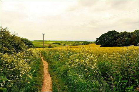
Wharram Percy lies about a mile (1.6 km) to the south of Wharram-le-Street and is signposted from the B1248 Beverley to Malton road.