Thixendale
OS grid reference:- SE 840 611
 The small and remote village of Thixendale lies at the spectacular confluence of six valleys in the beautiful countryside of the Yorkshire Wolds, and is situated around 20 miles to the east of York.
The village was mentioned as Sixtedale/Sixtendale/Xistendale in the Domesday book of 1086. Before 1066 it was owned by Gamal, son of Karli whose overlord was Wlatheof, Earl of Northumbria, after the Norman conquest it passed to Count Robert of Mortain, the half-brother of William the Conqueror. The derivation of the name 'Thixendale' is a matter of controversy. Some believe it derives from Sixteen Dales, as there are said to be 16 dales that lead in to Thixendale. Alternatively, 'Sigsten's Valley' has been suggested Sigsten/Sigsteinn is an Old Norse name.
During the medieval era, much of the land in the area was owned by the church. St. Mary's Abbey in York, and Kirkham Abbey owned large areas. Following the Dissolution of the Monasteries, this land reverted to the Crown and was then sold off.
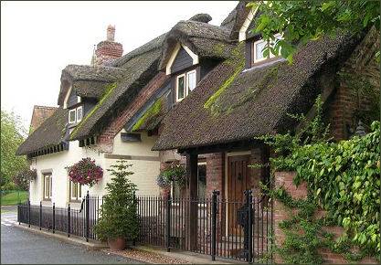
 The village is popular with walkers, it has a pub, the Cross Keys, a regular winner of local CAMRA awards, which serves excellent food and offers bed and breakfast accommodation.
Other bed and breakfast accommodation is available in the village.
The village is popular with walkers, it has a pub, the Cross Keys, a regular winner of local CAMRA awards, which serves excellent food and offers bed and breakfast accommodation.
Other bed and breakfast accommodation is available in the village.
There is also a cricket field, a village shop and Thixendale stores which offers an off license and a café. The former School house was once used as a Youth Hostel but is now serves as the village hall.
During the eighteenth century Thixendale came into the ownership of the Sykes family of Sledmere House and became part of the extensive Sledmere estates.
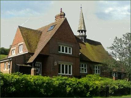
The church of St Mary, a Grade II listed building, is one of a number of buildings in the village including the school, vicarage, and school master's house which were constructed to designs in the Gothic vernacular style by George Edmund Street in 1868-70 for Sir Tatton Sykes II of Sledmere. The church is located on the Sykes Churches Trail devised by the East Yorkshire Historic Churches Group. Prior to the church's construction, the villagers had to walk 4 miles to Wharram Percy to attend the church there.
 A popular walk from the village leads to nearby Wharram Percy, the most studied deserted medieval village in England. The village was researched by combined teams of archaeologists, historians and even botanists, from about 1950 to 1990 after its identification in 1948 by economic historian Professor Maurice Beresford of the University of Leeds.
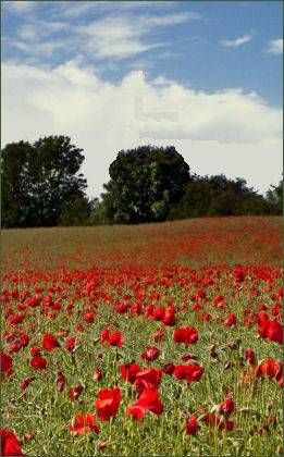
The Yorkshire Wolds Way National Trail passes to the east end of the village, a long distance trail runs for 79 miles from the Humber estuary to the dramatic Cleveland coast through the gentle chalk hills of the Yorkshire Wolds in typical downland scenery, with chalk grassland peppered with poppies, woodlands and dry valleys.
Art on the Yorkshire Wolds Way is an exciting programme to deliver 10 new public artworks by contemporary artists along the long distance trail. Waves and Time, at Thixendale was created by the artist Chris Drury and represents the ancient flow of ice and water through the area and how it has created the landscape we see today.
Towns and Villages of Yorkshire