Reeth
OS grid reference:-SE 037 991
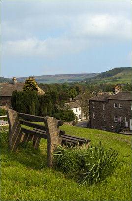
 The large village of Reeth, a popular tourist location, lies in a superb setting where Arkengarthdale and Swaledale meet to the east of Calver Hill , in the Yorkshire Dales National Park.
Reeth is situated mid-way between the attractive villages of Muker, Keld and Thwaite and lies around 11 miles to the west of the town of Richmond.
 The village boasts three pubs, the King's Arms, the Black Bull Hotel, which dates back to 1680 and the Buck Hotel, (pictured below left) an old coaching inn, all three serve meals.
There is also a post office, a village shop, several cafes and tea rooms and a hotel, the Burgoyne Hotel, which overlooks the pleasant, triangular village green and has been named as one of Alistair Sawday's 'Special Places to Stay'.
Reeth also contains one of five National Park Centres for the Yorkshire Dales, where visitors can find everything they need to explore the stunning Swaledale valley, learn about local walks along the River Swale or on the moors and obtain information on cycling and mountain biking in the area. The centre has a community orchard in its rear walled garden and is situated on a corner of the main square.
In the Anglo-Saxon era, Reeth was but a small settlement on the edge of a forest, but following the Norman Conquest it had grown sufficiently to merit being recorded in the Domesday Book of 1086. Later the village became a centre for hand-knitting and the centre of the local lead mining industry.
Both of these activities are featured in the Swaledale Folk Museum, with its fascinating exhibitions on the geology, mining and craft heritage of the Swaledale area. which is situated in the Old Merchant School in the village. The museum contains over 500 objects connected with life and work in the dale and is situated off the village green by the Post Office shop.
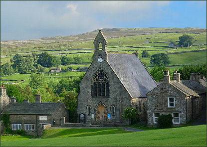
Reeth has two churches, the Reeth Evangelical Congregational Church which is situated on the sloping village green and Reeth Methodist Chapel, which has been in regular use since 1822, although Methodists have been worshipping in the village since at least 1766.
The Swaledale area of offers excellent walks, the nearby village of Grinton has a Norman church, with a Jacobean-style pulpit and a Lepers Squint. The ancient 'Corpse Way', is a 16 mile path which leads from Keld to St Andrew's Church, in Grinton. Mountain biking, a choice of walks, indoor and outdoor climbing, caving and kayaking along the River Swale all widely available around the market town.
Towns and Villages of Yorkshire