Whernside
OS grid reference:- SD 738 814
Whernside which rises to 2,415 feet (736 metres) is the highest mountain in Yorkshire, after Mickle Fell was ceded to Durham during the 1974 boundary changes. It is one of the Yorkshire Three Peaks, the other two being Ingleborough and Pen-y-Ghent. It is also one of the most popular peaks in Yorkshire and lies around 2 miles (3 km) to the northwest of the Ribblehead Viaduct on the Settle-Carlisle Railway. Its summit lies on the border of the neighbouring county of Cumbria.
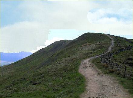
Whernside forms a long ridge, running roughly north to south. The rounded 'whale-back' shape is a result of land slippage which has masked the stepped layers of rock underneath.
There are three fells named Whernside in the Yorkshire Dales, Great Whernside, Little Whernside and Whernside. Whernside itself forms a long ridge, running roughly north to south. The views from the summit are superb, encompassing Ribblesdale and Chapel-le-Dale, down Dentdale and Kingsdale and further into the Lake District and Morecambe Bay on a clear day.
The word "Whern" is believed to refer to millstones whilst "side" derives from the Old Norse "sættr", meaning summer pasture.
Routes to the summit of Whernside
Access to Whernside can be had from various places.
The most popular approach is via a Right of Way footpath which runs from the east at Ribblehead which then follows north via Smithy Hill, Grain Ings before turning west to Knoutberry Haw and then south to Whernside. If attempted as part of the Yorkshire Three Peaks Challenge, Whernside will be climbed following the route up from Ribblehead to descend to Bruntscar.
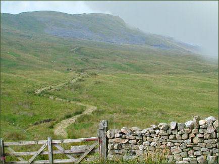
An alternative path leads west from the triangulation pillar to reach the road that is Deepdale Lane near White Shaw Moss. Another route runs north across Knoutberry Haw to pass Whernside Tarns and reaches the Craven Way at Boot of the Wold. Following the southern descent for 0.76 miles (1.22 km), instead of turning steeply southeast towards Bruntscar a path continues south running adjacent the wall passing Combe Scar and West Fell to reach the limestone pavements at Ewe's Top.